Our Region

The region contains four broad bio-regions: Cape York, the Wet Tropics, the Einsaleigh Uplands and the Gulf plains.
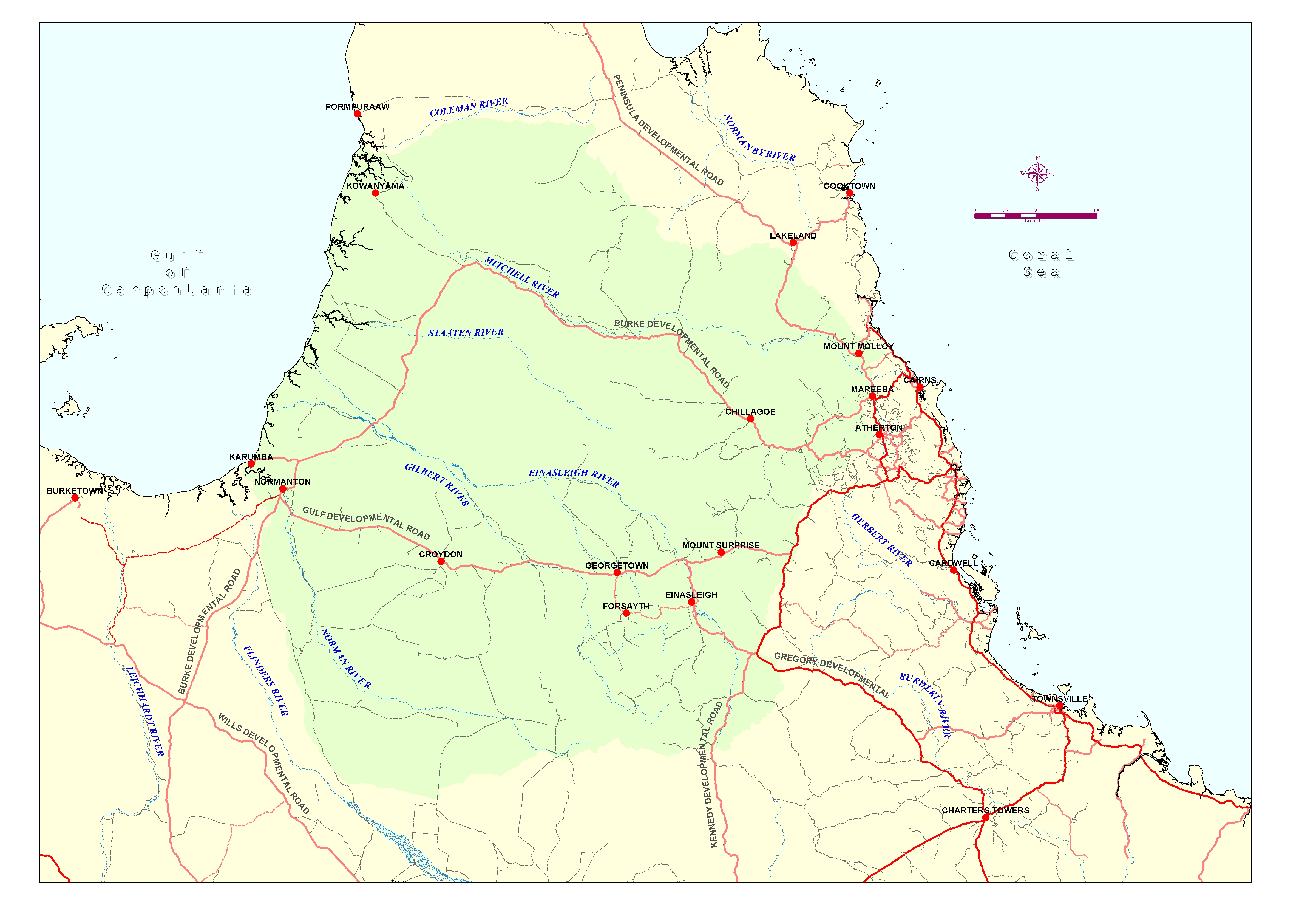
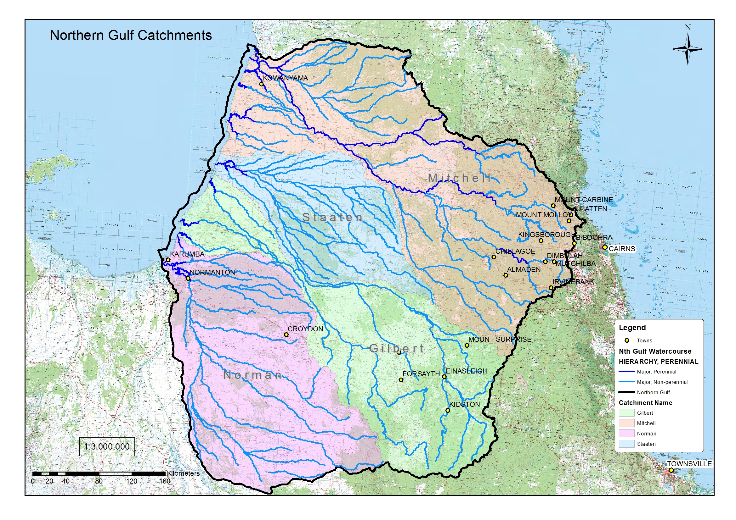
The Northern Gulf region’s settlement pattern is dispersed, and clustered in the Upper Mitchell catchment and along the Gulf coast, with a network of very small communities scattered throughout the Gulf plains and Einasleigh Uplands.
It includes the townships of:
-
- Almaden
- Chillagoe
- Dimbulah
- Einasleigh
- Forsayth
- Georgetown
- Irvinebank
- Julatten
-
- Karumba
- Kowanyama
- Mt Carbine
- Mt Molloy
- Mt Surprise
- Mutchilba
- Normanton
- Watsonville
As well as the western sheds of the Mareeba and Bihboora districts.
And the following Local Government Areas:
-
- Mareeba Shire (part)
- Croydon Shire
- Etheridge Shire
-
- Cook Shire (part)
- Carpentaria Shire (part)
- Kowanyama Shire
For the purposes of the NRM Plan, the Northern Gulf region has been separated into three, loosely defined sub-regions. These are:
-
The Gulf Coast, including the coastal strip, 15m above the sea level contour from the Carpentaria coastline, including the towns of Kowanyama, Karumba and Normanton, as well as the south-east Gulf of Carpentaria marine environment, extending in an arc of 150 nautical miles from the town of Karumba
-
The Grazing Lands, which is the vast expanse of remote dry tropical savannah, stretching from Palmer River catchment in the north-east to the Claraville plains in the south-west, and is dominated by broad hectare pastoral leases.
-
The Tablelands, which is the more densely populated part of the region, straddling the western shed of the Great Dividing Range, and includes the towns of Dimbulah, Mutchilba, Julatten, Mt Molloy, Irvinebank and Watsonville. This is a mixed use rural area with many small acreage and lifestyle blocks, but also includes the Mareeba Dimbulah Irrigation Area (MDIA) which supports range of horticultural industries including sugar cane, bananas and tropical fruits.